Coastal Infrastructure
Protecting New Yorkers against current and future coastal flooding.
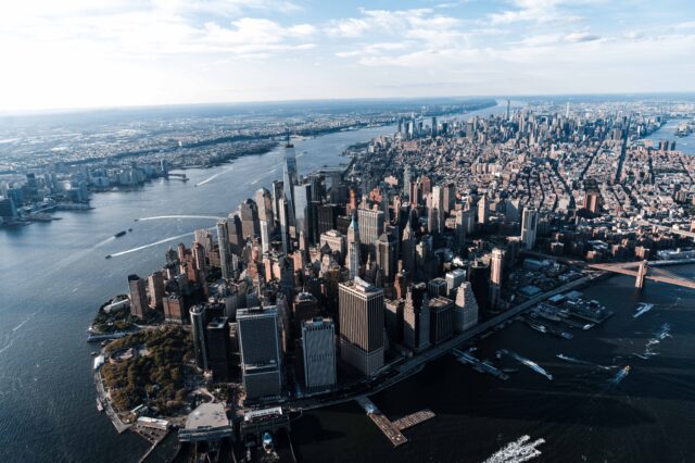
Since Hurricane Sandy in 2012, the City has created an entirely new class of infrastructure for the city–coastal protection projects that protect our waterfront neighborhoods from devastating storm surge and regular tidal flooding. These complex projects are among the first of their kind in a dense urban environment like New York City.
Integrating flood protections into New York City’s waterfront comes with many challenges. However, these generation-spanning projects will keep residents safe while also improving quality of life in waterfront neighborhoods, such as upgrading recreational spaces and increasing waterfront access.
In the Two Bridges neighborhood, the Department of Design and Construction (DDC) will install a combination of flood walls and deployable flip-up barriers to protect the neighborhood from a 100-year storm surge in the 2050s, while also maintaining access and visibility to the waterfront.
Adapting to Climate Change
In NYC, we’re working to reduce our greenhouse gas emissions as much as we can, as fast as we can. But even if we bring our emissions down to zero today, we will still be exposed to climate hazards like tidal flooding and more intense storms. That’s because emissions from the past are still affecting our planet, and will have an effect on us in the future.
We know that we must prepare our city for exposure to these hazards. That’s what we refer to as “adaptation.”
To adapt to a changing climate, the City has many kinds of projects at every scale, from very small to very large. The largest include neighborhood coastal flood protection projects.
What is a neighborhood coastal flood protection project?
A “neighborhood coastal flood protection project” is a large-scale capital project that reduces coastal flood risk for an entire or a significant portion of a neighborhood.
Each project is designed for the unique characteristics of each neighborhood to:
- reduce coastal flood risk from storm surges and tidal flooding
- maximize community benefits
- integrate and improve the public realm
These complex projects are among the first of their kind in a dense urban environment like New York City.
What does it do?
These projects can serve multiple purposes: they can reduce a waterfront neighborhood’s exposure to coastal storm surge and tidal flooding. They can also prevent shoreline erosion, and help with interior drainage. NYC has resources for designing coastal protection in the Neighborhood Coastal Flood Protection Project Planning Guidance.
These projects cannot remove all current and future risk of coastal flooding entirely. They are technically complex, costly, and can impact the environment around them. But they are a critical, powerful tool that give us significant protection.
NY& NJ Harbor & Tributaries Coastal Storm Risk Management Study (HATS)
The US Army Corps of Engineers (USACE) in partnership with New York DEC, New Jersey DEP, and the City of New York, will study the management of future coastal flood risk through the NY& NJ Harbor & Tributaries Coastal Storm Risk Management Study (HATS) to support the long-term resilience and sustainability of the coastal ecosystem and surrounding communities, and reduce the economic costs and risks associated with flood and storm events.
East Side Coastal Resiliency (ESCR)
ESCR is an integrated flood protection system that would spans 2.4 miles along the east side of Lower Manhattan waterfront from Montgomery Street north to E. 25th Street. It is comprised of combination of floodwalls, elevating East River Park approximately eight feet with flood protection beneath it, floodgates, and interior drainage infrastructure improvements. It will provide protection against storm surge and sea-level rise for 110,000 vulnerable New Yorkers while delivering critical waterfront open space and access improvements.
The Battery Coastal Resilience
The Battery project is being undertaken by NYCEDC in partnership with NYC Parks and MOCEJ. The project will rebuild and elevate the wharf promenade in The Battery, an important historic and revenue-generating asset for the city, staying true to the character and uses of the park, while protecting it from sea level rise in the year 2100. The project will also accommodate passenger ferry uses; preserve and enhance park character; use Universal Design principles to create a welcoming and accessible esplanade; and protect the park’s historic resources.
Battery Park City Resiliency Projects
In Battery Park City, the Battery Park City Authority (BPCA), is advancing a series of coastal protection projects to adapt to new climate conditions. The South Battery Park City Resiliency Project is a continuous flood barrier from the Museum of Jewish Heritage, through Wagner Park, across Pier A Plaza, and along the northern border of Historic Battery Park. The North & West Battery Park City Resiliency Project, will span the North Esplanade, extending into Tribeca. This area represents one of Battery Park City’s (and Lower Manhattan’s) most vulnerable points for storm surge inundation and flooding.
Brooklyn Bridge-Montgomery Coastal Resiliency (BMCR)
BMCR was originally kicked off by a grant through HUD’s National Disaster Resilience Competition in 2016 and fully funded by the City in 2021. This project will provide critical flood protection in the Two Bridges neighborhood with a series of deployable flip-up gates and floodwalls, while also maintaining access and visibility to the waterfront. It will protect 30,000 New Yorkers, forty percent of whom are public housing residents, and has the goal of FEMA accreditation resulting in a change in the FEMA Flood Insurance Rate Maps. NYCEDC led the design, while DDC will lead construction.
Financial District and Seaport Climate Resilience Master Plan
The Financial District and Seaport Climate Resilience Master Plan, released in December 2021, is a blueprint for comprehensive flood defense infrastructure for two low-lying neighborhoods, where nearly one million people work, live and commute through, from coastal storms and sea level rise. MOCEJ and NYCEDC will advance design, while applications are prepared for additional Federal funding. Implementation of the full plan is estimated to cost $5 – $7 billion.
Interim Flood Protection Measures Program
The Interim Flood Protection Measures Program (IFPM) is designed to protect critical facilities, infrastructure, and low-lying areas in New York City from low-level flooding caused by a hurricane. NYC Emergency Management manages the IFPM program in collaboration with the MOCEJ, and several other City agencies. The flood protection measures include: HESCO® barriers (fabric-lined wire mesh cubes filled with compacted sand) that are pre-deployed and placed where they do not impede traffic or use of a site; Tiger Dams™ (giant water-filled flexible fabric tubes designed to withstand floodwaters) that are deployed 24 to 72 hours before a coastal storm; and flood barriers (aluminum-based “walls”) that are placed in doorways, garages, and other open areas into a building that are deployed “just in time.” Many of the installations are meant to be de-installed once building- or asset-specific retrofits are completed, or neighborhood coastal protection projects implemented.
NYC Parks-Led Projects
There are few projects entirely under NYC Parks’ purview, that contribute to the citywide approach to coastal protection.
In the Rockaways, projects include the reconstruction of Bayswater Park in Edgemere, which will include a raised edge, restored natural areas, and low albedo playgrounds, and Thursby Basin Park, a new park construction that will include a raised edge and restored natural areas, in addition to permeable pavers and low albedo play areas. Both projects are being designed to coordinate with the USACE Rockaways – Bayside project.
The Tottenville Shoreline Protection Project project employs nature-based solutions such as an earthen berm, hybrid dune, eco-revetments, green infrastructure, and a restored wetland to mitigate existing and anticipated increases in coastal storm risk. It is being designed in coordination with New York State’s Living Breakwaters project located offshore.
Raised Shorelines Portfolio
The Raised Shorelines portfolio includes five projects – Old Howard Beach (two bulkheaded street ends project), Mott Basin (berm along the vulnerable edge of Mott Basin), Travis Avenue (raised section of Travis Avenue that transects a wetland), Mayberry (a revetment stabilizing the shoreline), and Coney Island Creek (strengthened and extended bulkheads) – that reinforce the shoreline to prevent erosion and mitigate tidal flooding from sea level rise by increasing the height of coastal edges. NYC EDC is now in the process of implementing these projects.
Red Hook Coastal Resiliency
Red Hook Coastal Resiliency, funded by FEMA and the New York State Division of Homeland Security and Emergency Services (DHSES) through an HMGP grant, and the City with capital funding, aims to reduce flood risk due to coastal storm surge and sea level rise along Red Hook’s waterfront while also integrating flood protection into the neighborhood fabric.
Rockaways – Atlantic Shorefront
USACE is constructing this 100% Federally funded project, spanning from Far Rockaway to Neponsit, to protect communities from future storms and strengthen the shoreline along over six miles of Rockaway Beach. The City announced groundbreaking for this project in October 2020, on the 8th anniversary of Hurricane Sandy. The project consists of a reinforced dune system, new and extended tapered groins to help trap sand and keep it in place, and extensive sand replenishment. Taken together, this project will reduce wave impacts and erosion.
Rockaways – Bayside
This is the second component of the USACE’s commitment in the Rockaways and is 100% Federally funded. This project involves constructing a system of berms, floodwalls, bulkheads, road ramps, pump stations, revetments, and nature-based features along the coastline in three flood-prone communities bordering Jamaica Bay (Arverne, Edgemere, Hammels). This project, designed for low elevation, high frequency flooding, including 5- and 10-year storms and sea level rise.
Seaport Coastal Resiliency Project
This standalone project of the larger Financial District and Seaport Climate Resilience Master Plan will protect the most low-lying and vulnerable part of the shoreline between Fulton Street and the Brooklyn Bridge, that includes almost 100 hundred buildings and 1,000+ jobs, against sea level rise and storm surge, mostly through raising the bulkhead.
South Shore Staten Island (SSSI) Coastal Storm Risk Management Project
This 5.3 mile-long coastal resiliency project from Fort Wadsworth to Oakwood Beach, a system of buried seawalls, floodwalls, levees, drainage ponds, and a deployable structure across Hylan Boulevard, is cost-shared between the City, USACE and the New York State Department of Environmental Conservation (NYS DEC). The project will protect 21,000 New Yorkers in an area that experienced the highest number of deaths during Hurricane Sandy than any other part of the city.
Take Action
When we bring our voices, our action, and our advocacy to our schools, our homes, and our workplaces, we can create a more sustainable and resilient future for the 8.3 million people who call our five boroughs home.
Take Action Now